
What makes a place remote? Is remoteness that which is geographically distant from the centre of administrative, political and economic activities? Or is remoteness a construct of connectivity? And is it fixed, or is it an outcome of politics and history?
Take the case of Monyul, wedged between Bhutan and Tibet in the North Eastern borderlands of India. Monyul is home to the Monpa communities, who are followers of Tibetan Buddhism. Monyul is a Tibetan term meaning lowland, while Monpa means lowlander. For the Monpas of Arunachal Pradesh in North East India, ‘remote’ denotes multiple aspects: lack of material infrastructure and transport, improper communication and geographical isolation. Living far away from New Delhi, the national capital, in a mountainous region on the Himalayan slopes, which remains cut off from other areas by snow or rain for a large part of the year, Monpas consider themselves to be backward, disempowered.
Yet, Monyul is of great strategic importance in the protracted border conflict between India and China. Since the India-China border war of 1962, during which Chinese troops militarily overran Monyul for two months before retreating, Monyul has been high on the defence and security radar of the Indian state. The cross-border passages between Monyul and Tibet are militarily sealed and there are permanent army settlements right up to the border. Far from the state being distant, state presence is a constant in this hyper-militarised zone.
What then makes a place remote?
Traditionally, Monyul was part of a trans-Himalayan circuit, in which traders, pilgrims, yak-herders, and kinsmen from Bhutan and Tibet moved. Popular memory stores narratives of trade; people speak of seasonal trade trips to the market at Tsona in Tibet before the border routes were sealed off. In 1680, the Fifth Dalai Lama declared all areas in and around Monyul as part of the Tibetan state, and Monpas were subject to Tibetan law and taxation until 1914, when the British colonial rulers mapped the Indo-Tibetan boundary. Even after this, Tibetan tax-collectors roamed these areas and Monpas continued to have cross-border relations with Tibet until 1950, when a paramilitary expedition sent by the postcolonial Indian government put an end to the de facto Tibetan rule. In present times, Monyul’s status as disputed territory and marginal border guides its spatial representations.
The transformation of this region from a trade corridor to a marginal enclave began during colonial rule. The British not only drew the McMahon Line as the Indo-Tibetan boundary, dividing Monyul from Tibet, but also implemented the Bengal Regulation Act of 1873, which drew a boundary known as the Inner Line, roughly dividing the hills from the plains areas in North East India. While the stated objective of the Inner Line was to protect the hill tribes and their land from encroachment and control by outsiders, the actual motive was to safeguard expanding British commercial interests of tea, oil, and rubber in the plains by reducing contact and possible friction between hills and plains dwellers. Further, British interest in this region was not actually governance but the need to construct a buffer between China and British Indian territories, since Tibet was under threat of being occupied. Creating a buffer out of Monyul meant it had to be maintained as a neutral zone with minimum state interference, which could then be forfeited without much loss in case of enemy expansion. Colonial governmentality in insecure frontiers led to Monyul remaining under a system of loose administration.
In 1943, in the twilight of colonial rule, the British government attempted to extend certain development works in the frontier areas of North East India, and for this purpose, conceived of the first Five Year Development Plan in 1946. Development, according to this plan, rather than a change of buffer strategy, was conceived as a tool to propagate the image of the benevolent state in the minds of the local Monpa population and also wean the latter away from Tibetan influence, given that Tibetan officials were still collecting taxes in Monyul until the early 1940s. Actual work for the Five Year Development Plan began only in November 1947 – after India had gained independence. However, as with many policies of the immediate decolonization period, this development plan, too, reflected a continuity rather than break with colonial ideas of governance.
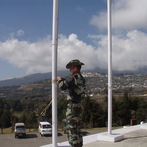
Photo by gkrishna63 (flickr, CC BY-ND 2.0)
Development in the late colonial period and immediate post-colonial period had a two-pronged objective; first, to expand a tenuous administration to hitherto un-administered territory, and second, through roads, hospitals and schools, to signal to the subject populations who the legitimate authority in these areas was. Especially road construction was seen as a priority. It was a selective form of development, primarily intended to pave the way for non-military penetration of the state into these border areas.
The dilemma of the postcolonial Indian government, concerned with nation-building and integration in the 1950s, was whether to adopt a strict policy of assimilation or to continue the earlier strategy of isolationism with regard to the frontier tribes.
Verrier Elwin, missionary turned anthropologist and national advisor on tribal affairs, advocated a policy that would respect tribal rights over land and forest and allow tribals to develop on their own, without “over-administering” their areas. Eventually, the approach of non-interference and gradual assimilation favoured by Elwin was adopted. In the postcolonial period, Arunachal Pradesh remains a restricted area requiring an Inner Line Permit for Indian citizens who are not natives of the region, and a Protected Area Permit for all foreign nationals. The Inner Line continues to restrict entry and settlement of non-natives in many of the frontier regions of North East India, including Arunachal Pradesh. At the same time, a benevolent state presence has to be exercised in these areas so that national boundaries are impressed on the psychology of border people. In this regard, development plays a role in fashioning border subjects.
In the period up to the Sino-Indian war and in its aftermath, military activities were appended to development in order to establish state presence in the Monyul border. But this development is of a selective kind that lays emphasis on roads and less on healthcare, education or employment. But roads too are constructed largely from a military point of view, connecting main towns and army settlements rather than rural areas, while those roads that are not strategically important are neglected. Army settlements have been built at a frequency of every 30-40 kilometre stretch on the main road, the national highway that winds its way up hilly terrain from the adjacent Assam plains to the India-Tibet border. The perceived spaces of Monyul today combine images of a remote border with that of a militarized frontier. Geographically and socially, the Monpas live an enclave existence, trapped by the border and separated from centers of power and commerce.
Security, infrastructure, connectivity
We see in the case of Monyul that remoteness is not correlated to population or state presence. Monyul is not an “out-of-the-way” place in the sense of being overlooked; in fact, there is too much attention on it, especially in the media, which is inflated from time to time, whenever there are news reports about Chinese incursion into Indian territories. The state is not far away from Monyul but exercises a hyper-surveillance here through its military arm.
What makes a place remote or gives it that spatial optic accrues from both emic and etic representations. People often focus on certain things they do not have access to – industry and easy availability of produce; presence of cinemas and super markets; urban amenities and public transport – which makes it seem like remoteness is a simple factor of infrastructure and connectivity.
However, scholars have agreed that remoteness is a relative concept: two geographical locations may be equally distant in topographic space from a third location, but the connectedness in physical and conceptual space of the two may not be the same. Remoteness is not determined by geographical criteria but emerges through social construction, and yet, it induces a general perception of space as well as a state of mind among the inhabitants of the place.
Here I bring up Michael Mann’s concept of “infrastructural power”, which emphasizes how infrastructure constitutes a privileged institutional channel for social regulation, as well as the the power of the state to penetrate and coordinate all aspects of civil society though its own infrastructure. If infrastructures of communication can allow state penetration, their denial or selective withholding can also act to regulate populations through a politics of access. Indeed, in Monyul and many militarized borders, the army is often the agent of development activities, supplying basic necessities, air-dropping supplies and carrying out road construction work, so much so that the local people become dependent on military help for basic survival supplies.
Security, selective connectivity and infrastructural development are related modalities of state control and work together to make and remake Monyul’s remoteness over and over again.
Featured image by BOMBMAN (flickr, CC BY 2.0)